
Get ready for an impactful weekend storm!
First, let’s talk about your Valentine’s night plans. Temperatures will go from the 20s in the evening, but with that whipping wind, that’ll feel like the teens. Overnight actual low temperatures will get down to the teens.
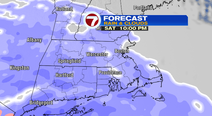
Your Saturday will be a chilly one with highs only reaching the upper 20s and low 30s. It won’t be as windy, but it won’t be nearly as bright. Clouds will be around ahead of the anticipated snow Saturday night.
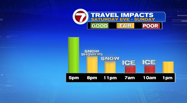
Scattered, light snow moves in from the west to the east from 5-8 p.m. That won’t be the worst of the storm. In fact, that’ll be the least impactful time of the storm.
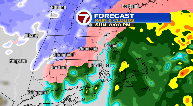
The snow becomes heavier and more widespread past 10 p.m. and that will churn overnight. However, toward early Sunday morning, we will see a change in precipitation. That change from snow to a wintry mix, sleet and freezing rain will happen first from the south as early as 2/3 a.m. for the islands. As the morning progresses, that sleet and freezing rain line will advance north. Eventually, areas farther south than that, will make the switch over to plain rain.
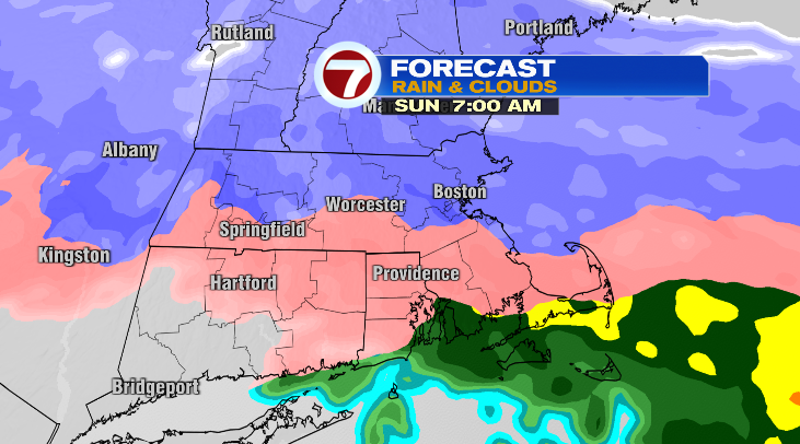
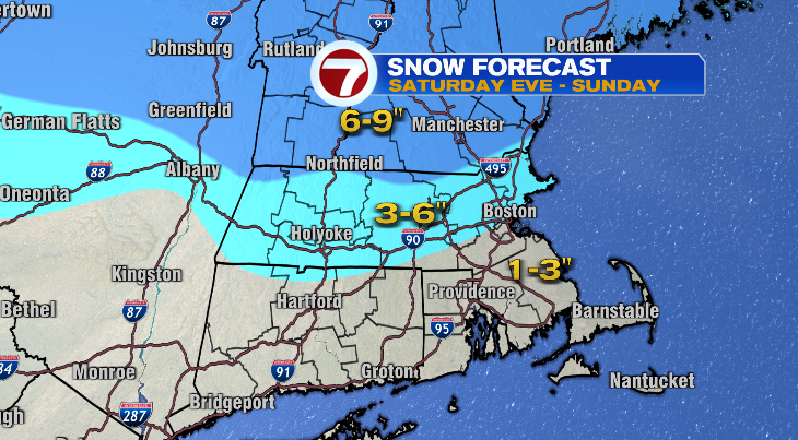
Before that changeover happens and compacting and melting of the snow occurs, most of us will pick up 3-6″ of snow with lesser totals where the snow ends the earliest across the southeast.
A lot of Sunday will be marked by that changeover from snow to a mix, sleet and freezing rain.
That’s when the ice will accumulate, and that’s when road conditions will suffer significantly.
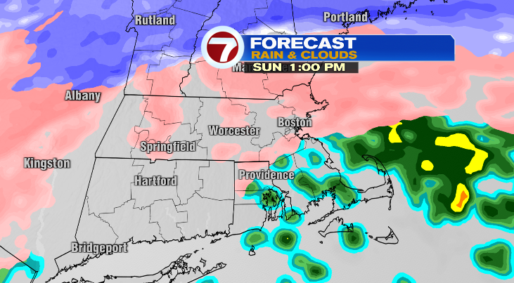
It will be very location dependent, but as we get into Sunday evening, plain rain is likely south and east with snow or freezing rain and sleet lingering north and west.
Sunday will be the worst day this weekend with those icy conditions expected.
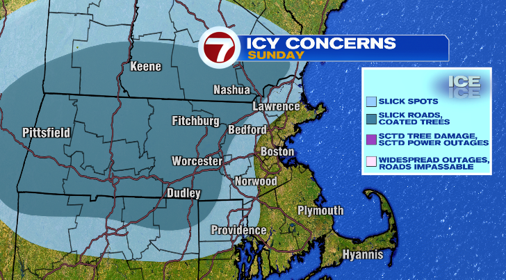
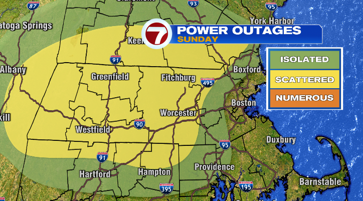
With trees coated in ice comes a risk for some power outages, too, so if you live in Worcester and Middlesex counties especially, I’d keep your electronics charged up.
High temperatures Sunday will be widely variable since it’s a warm front bringing the change in precipitation. It’ll be coldest in the 30s north and west of Boston while the southeast, Cape and the islands will be much warmer in the 40s. But beware Sunday night. Temperatures will come crashing down. So whether you primarily get snow/sleet, or primarily get a mix/rain Sunday, all of it will freeze up Sunday night. With high temperatures not making it out of the 20s Monday, every surface that goes untreated will stay frozen.
As a result, Monday’s commutes could be pretty icy. Make sure to go slow.
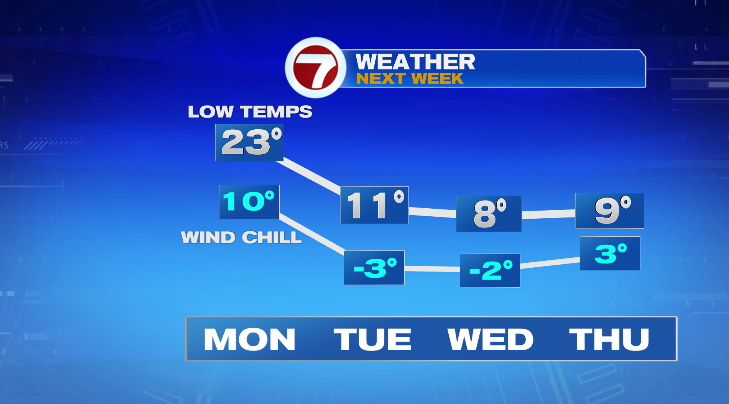
After Monday we have our next Arctic blast. Tuesday through Thursday morning lows will be in the single digits and teens with highs only in the 20s. Our next chance for a storm comes again Thursday into Friday morning.